I’m reminded of the hit song “Radar Love” by Golden Earring released in 1973 every time I flip the toggle switch to turn on RADAR aboard Skiron. I was 12 years old. The song was popular for years as I used to hear it driving at night long after I received my driver’s license at age 16.5 years.
I do love RADAR!!
I won’t go into all the advantages and limitations of such. I’ll comment on a few thoughts and relate a few stories.
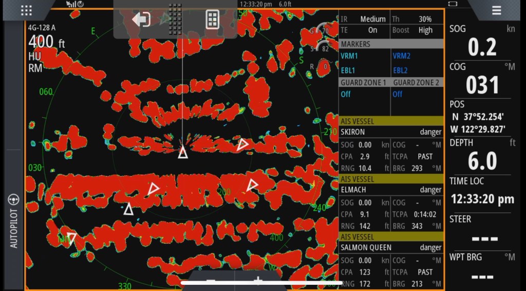
The above image is a screen capture RADAR display from Skiron this afternoon. I’ve no doubt that, if fog was so thick that visibility was to the bow of the boat, I could safely get out of the harbor with RADAR.
I remember being required to navigate a helmsman around and through PIllar Point Harbor from below one morning as an exercise in reading and interpreting RADAR. “ Right rudder 10 degrees…” and so on. It was a great exercise and worthwhile if you have eyes topside.
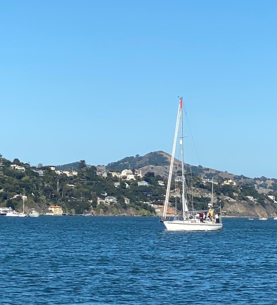
I’ve become accustomed to RADAR signals of different types of vessels and other objects, such as buoys, on the water. It’s great to have an AIS overlay. One gets accustomed to the appearance of land. Do yo nite the curved line of objects in front of my vessel in the photograph above? That’s the curvature of a hillock peninsula in front of my vessel. It’s distinctly different from the straight edges of the docked vessels.
RADAR is critically important for seeing through fog or other weather and in collision avoidance. I’ve seen all sorts of vessels before they emerge into the realm of visibility. There are well-defined response plans as to how to best avoid a vessel seen on RADAR that appears to be on a collision course depending on its course, location, and quadrant. MARPA is something that I’m gaining familiarity with these days.
I regularly employ RADAR in coastal navigation in limited visibility an even when visibility is unrestricted. Two to three radar ranges and circular lines of position accurately place the location of a vessel provided one chooses the appropriate and approximate coastal boundary of the target. Bearings are accurate to within 2-5 degrees so are less reliable when navigating but there is no substitute to a range and bearing to a known object to confirm that you’re close to where you wish to be or to confirm that you’re close to an intended track.
I tend not to buoy hop when sailing in the ocean but I’m sure comforted when seeing buoys on RADAR while sailing in limited visibility. On a recent sail, we weee able to confirm our course into Pillar Point Harbor in fog with visibility of less than 50 meters by identifying first, PP safe water mark then the G and R buoys. It’s also nice to see the line of buoys on approach to the shipping channel to SF approaching from the south in limited visibility.
I was skippering a vessel for a group of Club Nautique sailors a few years ago. Sales were up and we had seven lots underway across the bay. It was about 7 PM. Middle of summer. We could see the fog coming in from now to see through the Golden Gate channel. We didn’t expect it to descend upon us in the matter of just a few minutes. We couldn’t see anything around us. We were somewhere to the lee side of Alcatraz. fortunately, I had insisted that we turn the radar on and transmit at the beginning of the sail. I ordered the sails to be furled, slowed the vessel considerably, set a forward and rear lookout, had a crewman begin our sound signals for motoring underway in limited visibility, turned over the helm to a competent crew member, and took over the radar watch. I gave the helmsman directional instructions to avoid at least two separate buoys, two islands, two vessels, and to motor us back toward the Sausalito channel. We exited the fog bank relieved but also confident that the things we had been taught paid off to ensure our safety that evening.
I know better than to go out in the Pacific Ocean along our coast in a storm. I do understand, however, that radar can see storm sales off in the distance and assist in making preparations for rough weather. I don’t have any plans to gain that experience anytime soon. it would be different if I were planning to sail in regions where storms are frequent.
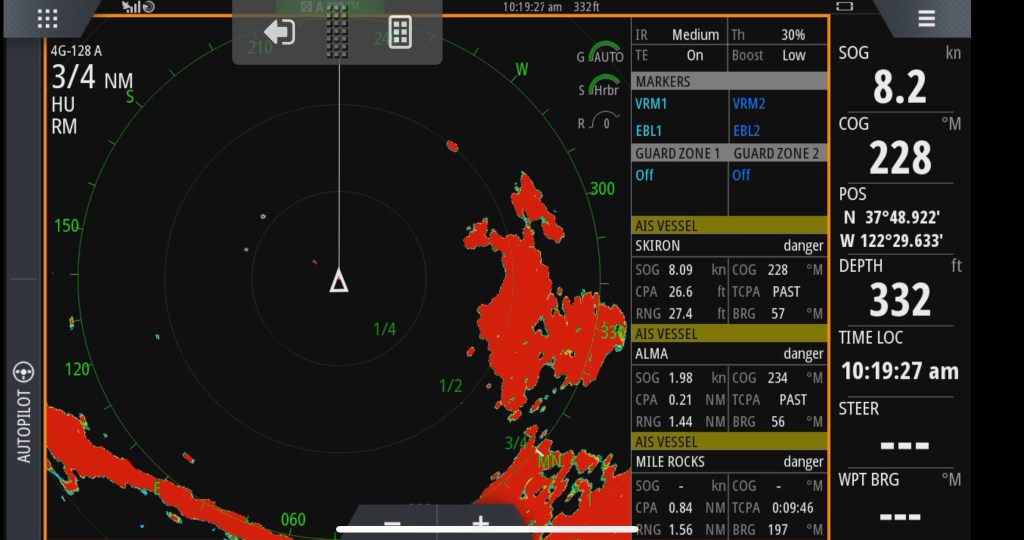
In the image above, I am the center white triangle in the Golden Gate channel. The Golden Gate Bridge is the diagonal return in the lower left corner. The Marin headlands are the irregular shaped returns to the right of the vessel. The little hook that is at 2 o’clock is point Bonita. The little orange return at 1 o’clock is the Red/Green preferred channel buoy at the start of the Bonita channel.

If you have RADAR then use it. It’s best to have it on rather than off. Collision Regulations require one to use it if it’s on a vessel. Learn to do so. Have fun!